

Jökulsárgljúfur Canyon, one of the most spectacular sights in North Iceland
Among all the magnificent sites in Iceland’s northern region, there’s one that is often overlooked, but that defines the raw side of this region. Jökulsárgljúfur Canyon stands out as a titan of geological history, a place where the raw power of water and fire has carved a masterpiece into the earth. This long ravine is like an open-air museum, as it has a few surprising elements inside.
Come with us to learn everything there’s to know about this crown jewel.
Key Takeaways
- Jökulsárgljúfur is a spectacular canyon located in North Iceland.
- It’s 25 kilometers (15.5 miles) long and up to 100 meters (330 feet) deep.
- It has several waterfalls inside.
What is Jökulsárgljúfur?
Jökulsárgljúfur is a massive canyon located in Northeast Iceland. It’s part of the Northeastern Region, called Norðurland Eystra in Icelandic. It has an approximate length of 25 kilometers (15.5 miles) and, in certain points, is as wide as 500 meters (1,640 feet). For decades, the area was protected as Jökulsárgljúfur National Park, established in 1973. However, in 2008, it was integrated into the much larger Vatnajökull National Park, the largest national park in Iceland and Europe. This change linked the canyon to the glacier that created it, even though the two areas are separated by several miles of highland desert.
The canyon is famous for housing a series of spectacular waterfalls, most notably Dettifoss, one of the most iconic waterfalls in Iceland. However, it is much more than just a home for falling water. It is a place of deep contrasts, where arid plateaus meet lush, green oases like Ásbyrgi. The canyon can be divided into several distinct areas, each with its own character: the dramatic falls of the south, the strange rock formations of Vesturdalur in the center, and the forest inside of Ásbyrgi Canyon in the north.
Historically, the area was quite remote and difficult to get to, but today it’s one of the most significant stops on the Diamond Circle, a scenic route that connects the best things to see in North Iceland. Jökulsárgljúfur is not technically one of the stops, but Dettifoss and Ásbyrgi are, and they form part of this long Canyon. It’s a fantastic destination for a campervan trip through Iceland. It combines amazing scenery with several campsites nearby where you can spend the night.
Geology and Legends about Jökulsárgljúfur Canyon
The history of Jökulsárgljúfur is a series of catastrophic events. Unlike many canyons that are formed by constant erosion over millions of years, Jökulsárgljúfur was largely shaped by "jökulhlaups" (devastating glacial floods). These floods occurred when volcanic eruptions under the Vatnajökull ice cap melted massive amounts of ice, sending huge amounts of water down toward the coast. Scientists believe these floods were among the most powerful since the last Ice Age, obliterating the floor on their way and deepening the canyon in a matter of days or weeks. These floods didn't just happen once; they occurred in massive pulses roughly several times in history, each time radically reshaping the landscape you can see today.
As we were saying, the canyon walls are made of basalt, a volcanic rock. Different layers can be seen there, like a vertical timeline of the region's volcanic activity. In areas like Hljóðaklettar (the Echo Rocks), you can see rare honeycomb basalt formations and twisted columns that look like they were sculpted by a giant’s hand. Basalt is formed when lava meets water or ice and cools down causing it to crack into geometrical patterns, mostly hexagonal columns.
Naturally, such a dramatic landscape has inspired many legends. In Iceland, the appearance of some places is so rare and unique that the first settlers tried to explain their formation with mythological stories. The most famous in this area is the origin of Ásbyrgi, the horseshoe-shaped canyon at the northern end. The glacial floods we explained before are its origin; medieval Icelanders believed that Ásbyrgi was formed when Sleipnir, the eight-legged horse of the god Odin, stepped down from the heavens, leaving a massive hoofprint in the earth.
Facts about Jökulsárgljúfur Canyon
Leaving mythology aside, let’s see some data about Jökulsárgljúfur, starting with its name. The word Jökulsárgljúfur is complicated for many travelers, but it perfectly describes the place itself. Natural places often have descriptive names, and this one is no different. Jökulsárgljúfur can be translated as "Glacial River Canyon." Jökull is glacier; ár means river; and glúfur is canyon. There you go.
Geographically, it is one of the most impressive landscapes in the country, with a length of 25 kilometers (15.5 miles). The canyon’s depth is equally impressive, with the walls reaching up to 100 meters (330 feet) in height. Some parts are gentler while others are completely vertical. In terms of width, the gorge reaches 500 meters (1,640 feet) in its wider sections.
The river responsible for this carving, Jökulsá á Fjöllum, is the second-longest in Iceland and carries loads of sediment from the Vatnajökull glacier, giving it its milky-grey color. The river’s level is more or less constant throughout the whole year, but it’s at its best in late spring and early summer. Just think that Europe’s second most powerful waterfall, Dettifoss, is part of this river.

Where's Jökulsárgljúfur Canyon and How to Get There?
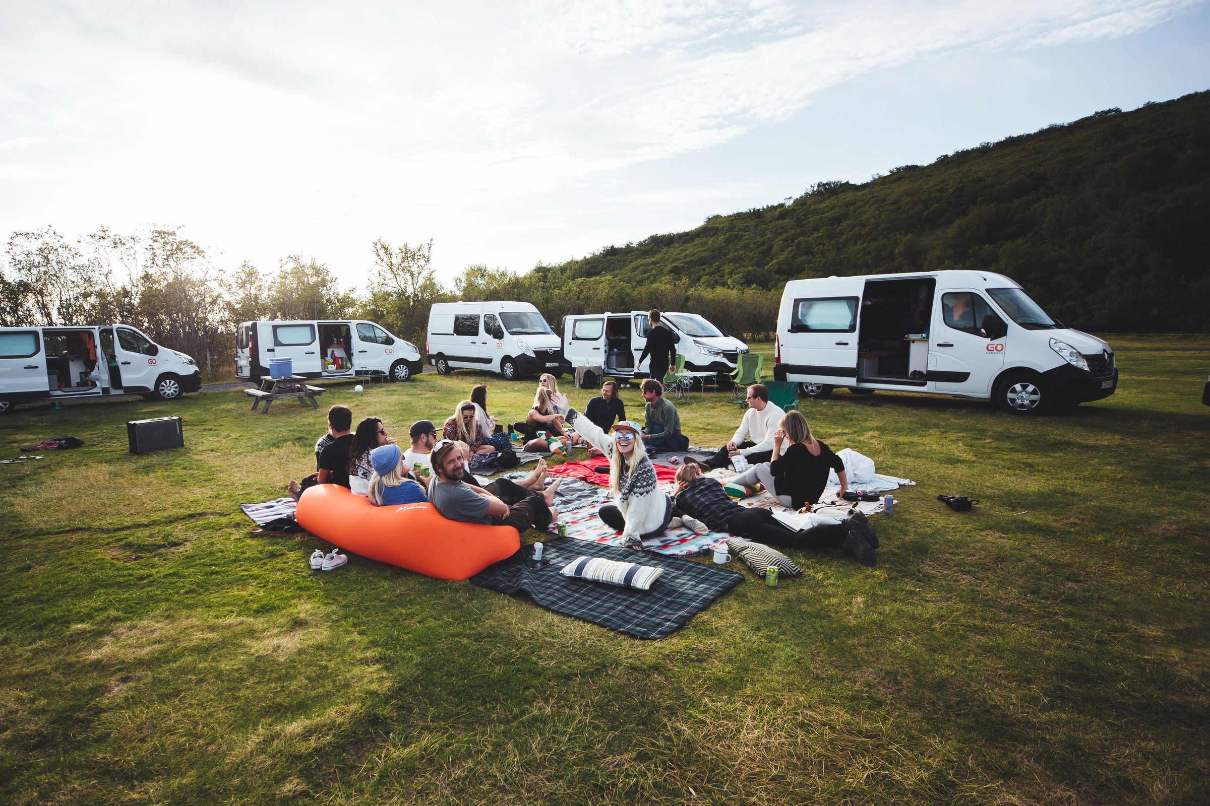
Jökulsárgljúfur is located in North Iceland, more precisely in the Northeastern Region. The best way to get there is undoubtedly in a campervan or car. Having your own wheels and your own bed allows you to go there at your own pace and then go to a camping round for the night.
If you’re coming from Reykjavik, the journey from the capital is long but quite scenic. The total distance is approximately 530 kilometers (330 miles), which usually takes about 7 hours without stops. However, in a campervan, you’ll likely take 2-3 days to reach this point, stopping at the many sights along the way.
From Reykjavik, you just have to take the Ring Road (Route 1) heading north. Not long after you’ve passed Akureyri, the most important city in North Iceland, turn left onto Route 85. Drive on it for 107 kilometers (66 miles) until you see a smaller road on the right, Route 862, with a sign that says Dettifoss. That road goes along the canyon’s west side.
Alternatively, you can skip the turn for Route 85 and continue on the Ring Road for another 80 kilometers (50 miles) and then turn left onto Route 862, accessing the canyon from the south side.

Where to Stay Near Jökulsárgljúfur Canyon
Staying near Jökulsárgljúfur canyon is easier than you’d think, as there are several nice campgrounds in the area.
Ásbyrgi Camping Ground
Distance to Jökulsárgljúfur Canyon: Located at the northern entrance. 16 km (10 miles) to the parking area in the middle. Opening Period: May 15th to September 30th.
This is widely considered one of the top campsites in all of Iceland. It’s located by the birch woods near Ásbyrgi, the astonishing canyon marks the north end of Jökulsárgljúfur. The natural environment is outstanding, and there are trees that shelter the pitches from the wind. It has toilets, showers, electricity, cooking facilities and a laundry room. It’s quite big, with capacity for 500 people, but it’s recommended to book in advance, as it’s quite popular. Some of the trails that go to the canyon start right at the camping ground.
Lundur Campsite
Distance to Jökulsárgljúfur Canyon: 5 km (3 miles) to the northern entrance. 21 km (13 miles) to the parking area. Opening Period: June 10th to August 31st.
Also in the Ásbyrgi area and not far from the coast, Lundur is located at a local farm and offers a very peaceful atmosphere. It features flat grassy pitches with electricity, toilets, showers, and outdoor sink. It’s a basic camping ground, but it’s close to services and activities, such as a playground for children, a shop, and a restaurant. The camping area is a large, flat green field that is perfect for parking your campervan and setting up for the night.
Mánárbakki - Camping 66.12° North
Distance to Jökulsárgljúfur Canyon: 50 km (31 miles) to the parking area. Opening Period: March 1st to November 15th.
This campsite is perched right on the edge of the world on the Tjörnes peninsula. It is famous for its "edge of the world" coastal views. This campsite offers toilets, showers, washing machine and dryer, kitchen, and common area. A small museum and restaurant operate on site during the season. Its location, over the sea, makes sunsets especially memorable from the terrace.
Húsavík Camping Ground
Distance to Jökulsárgljúfur Canyon: 72 km (44.7 miles) to the parking area. Opening Period: May 15th to September 30th.
If you prefer to be closer to civilization, this is your best option. The Húsavík campsite is located on a hill overlooking the whale-watching capital of Iceland. It sits within walking distance of the harbor, grocery store, and swimming pool. The facilities include toilets, two hot showers, a washing machine, cooking area, free Wi-Fi, and electricity hookups. The central position makes it perfect for campervan travelers who want to visit GeoSea on foot or want to stay close to all the services that can be found in Húsavík. There’s also a disc golf course next door.
Heiðarbær Campsite
Distance to Jökulsárgljúfur Canyon: 92 km (57 miles) to the parking area. Opening Period: June 1st to September 15th.
This well-equipped site lies south of Húsavík on Route 87. It’s one of the most complete camping grounds in North Iceland. The site offers excellent services, including wheelchair accessibility, toilets, electricity, showers, cooking facilities, seating area, grocery store, restaurant, bar, café, barbecue, golf course, hiking trails, walking paths, sport area, playground, horse rental, fishing, and medical help.
Grímsstaðir Camping Ground
Distance to Jökulsárgljúfur Canyon: 55 km (34 miles) to the parking area. Opening Period: May to September.
This camping ground sits on an old farm close to the Ring Road. It has spaces for tents and campervans with basic facilities, including toilets and a sink for washing dishes. The site also includes a guesthouse with rooms where you can use your own sleeping bag or rent one there.
Kópasker Camping Ground
Distance to Jökulsárgljúfur Canyon: 51 km (31.7 miles) to the parking area. Opening Period: June to September.
Located in the tiny, quiet village of Kópasker on the Melrakkaslétta peninsula, this campsite is perfect for travelers who want to escape the main tourist circuit. It is a peaceful, grassy area with all the basic necessities: toilets, electricity, and a small indoor area. The village itself is charming and features a unique earthquake center museum. The atmosphere here is very local and relaxed, providing a nice contrast to the busier sites further south.

What to See and Do Near Jökulsárgljúfur Canyon
Although it is not, per se, an official stop in the Diamond Circle, Jökulsárgljúfur Canyon is a key part of the marvelous scenic route.
Dettifoss
You haven't truly seen the power of nature until you've stood next to Dettifoss. The sheer volume of water crashing over the edge creates a thunderous roar that you can hear from quite some distance. The mist from the falls often creates rainbows on sunny days, but it also means you’ll get wet, very wet. There are viewpoints on both the east and west sides of the canyon, each offering a different perspective. The west side (Route 862) is more accessible, while the east side (Route 864) lets you get right up to the water’s edge.

Hólmárfossar and Réttarfoss
While Dettifoss is the star of the show, these two waterfalls offer a more peaceful, intimate connection with the canyon. Hólmárfossar is particularly beautiful; it’s a collection of springs that emerge directly from the canyon’s basalt walls, creating a hanging garden of moss and wildflowers. The water tumbles into the Jökulsá river in several streams. Réttarfoss is a broader, more powerful waterfall further downstream. Visiting these requires a bit of hiking, meaning you often have the landscape all to yourself. The trails here are well-marked but can be rocky, offering fantastic views of the canyon's mid-section.
Ásbyrgi Canyon
Ásbyrgi is a geological wonder that needs to be seen from both below and above. At ground level, you can walk through the birch forest, a rarity in Iceland, there are not many trees on this island, to the pond Botnstjörn, which sits at the very end of the horseshoe. The water is often perfectly still, reflecting the 100-meter-high cliffs. If you have the energy, take the hike up to the "Eyjan" (The Island), a massive rock formation in the center of the canyon that offers a 360-degree view of the entire area. It’s one of the most beautiful spots in the country and is steeped in folklore, as we saw before.

Lake Mývatn
Formed by an eruption over 2,000 years ago, Lake Mývatn is a volcanic wonderland. This lake, with its water of an intense blue hue, is surrounded by lava fields and bubbling mud pots, as it is an active geothermal area. You’ll also find pseudo craters, formed when lava met water and cooled down rapidly. The lake is surrounded by wetlands that are full of different bird species, such as the harlequin duck, the tufted duck, or the common snipe, among others. Summer is the best time to see them. Close to the lake’s shore, there’s another fantastic geothermal spa, the Mývatn Nature Baths. Don’t miss out on Dimmuborgir, a labyrinth of lava rock formations.

Húsavík
Húsavík is often cited as one of the prettiest towns in Iceland, and it’s hard to disagree. It is the best place in Europe for whale watching, with boats departing several times a day to find humpbacks, minke whales, and even the massive blue whale. The town has a wonderful, laid-back vibe, with several excellent seafood restaurants along the harbor. It’s a great place to stop for a few hours or a whole day to enjoy the coastal culture and history of the north.

GeoSea Geothermal Sea Baths
Geothermal bathing is a key element of Icelandic culture, and there’s a great place just outside Húsavík for it. This spa is different from the rest in the country because it uses sea water in its pools. The water is heated naturally using geothermal energy. The infinity pools look out over the bay toward the Arctic Circle. If you visit in the evening, you can watch the sunset from the water, and in the winter, it’s one of the best places to view the Northern Lights while staying warm. It’s a modern facility that perfectly balances luxury with the raw beauty of the coastline.

Arctic Henge
Located in Raufarhöfn, the northernmost town in mainland Iceland, the Arctic Henge is a massive stone monument inspired by the world of Norse mythology. It is designed like a giant sundial, with four main arches, each oriented to the four cardinal spots, that capture the light of the sun during the solstices and equinoxes. Each of these gates is about 6 meters high, aligned to the cardinal directions. At the center there’s a 10-meter column. Around, there are 72 smaller stones, each representing a dwarf from the ancient Eddic poem Völuspá, which tells the story of the creation, destruction, and rebirth of the world in Norse lore.

The Seasons at Jökulsárgljúfur Canyon
Your experience visiting Jökulsárgljúfur will differ a lot depending on the season you go. Here’s a scope for what to expect.
Spring (April and May):
With the arrival of this season, the snow begins to melt gradually. This is when the river Jökulsá á Fjöllum is at its most turbulent, especially in late May, carrying massive amounts of meltwater from the highlands. Temperatures range from -2°C to 7°C (28 to 44°F). Roads can be muddy, and some hiking trails may still be closed, but the waterfalls are at their most violent and impressive.
Summer (June to August)
This is the prime time for campervan travel. The days are really long, with almost 24 hours of natural light by the end of June. You can visit the canyon very late in the evening and still have light. Temperatures are mild, ranging from 8°C to 15°C (46 to 59°F). This is the only time all hiking trails and roads in both sides of the canyon (Road 864 and 862) are guaranteed to be accessible. It’s also the best time for whale watching in nearby Húsavík.
Autumn (September and October)
This season brings shorter days but incredible colors. The birch trees in Ásbyrgi turn deep gold and red, contrasting with the dark basalt of the cliff’s walls. Temperatures drop to between 2°C and 10°C (35 to 50°F). This is a great time to avoid the crowds, though you should be prepared for higher winds and the first snowfalls of the year.
Winter (November to March)
Winters are long and cold in North Iceland. In this season, the canyon is transformed into a world of ice. Most of the waterfalls freeze partially, creating giant ice sculptures. Temperatures hover between -10°C and 2°C (14 to 35°F). Access is significantly limited; the road to the east side is closed, and the west side is only occasionally plowed. This season is only for those with a 4x4 camper and significant winter driving experience.

What to Pack to Visit Jökulsárgljúfur Canyon
- Waterproof Jacket and Pants: A high-quality raincoat and waterproof pants are non-negotiable due to the waterfall spray and unpredictable Icelandic weather. Rain can hit at any moment.
- Sturdy Hiking Boots: The terrain around the canyon is rocky and can be slippery.
- Dress in Layers: Think thermal inner layer; wool or fleece mid-layers to regulate your temperature; and the outer waterproof shell.
- Reusable Water Bottle: Icelandic tap water is some of the best in the world; fill up for free!
- Power Bank: To keep your devices charged in long days out.
- Quick-dry Towel: Essential for campsites or a dip in a geothermal pool.

Travel Tips
- Check the Road Conditions: Always visit the Icelandic Road and Coastal Administration website before you start driving, especially outside summer.
- Fuel Up: There are no gas stations near the canyon. Fill your campervan in Húsavík or Akureyri before heading in.
- Respect the Barriers: The canyon walls are unstable in places. Stay on marked paths for your safety and to protect the fragile ecosystem.
- Arrive Early: Dettifoss can get busy between 11 AM and 3 PM. Arriving early or late allows you to enjoy the power of the falls in peace.
- Download Offline Maps: Cell service can be spotty in the deeper parts of the canyon. You can also get an old-school paper one.
Conclusion
Some places in Iceland remain hidden while being in plain sight. Jökulsárgljúfur Canyon is not the typical place that comes up in a search of destinations in Iceland, but it’s one of the most complete experiences you can enjoy in this country. It has a bit of everything this country is known for. Add it to your travel list. You won’t regret it.


