Discovering the Wonders of Landmannalaugar in Iceland: Your Ultimate Guide
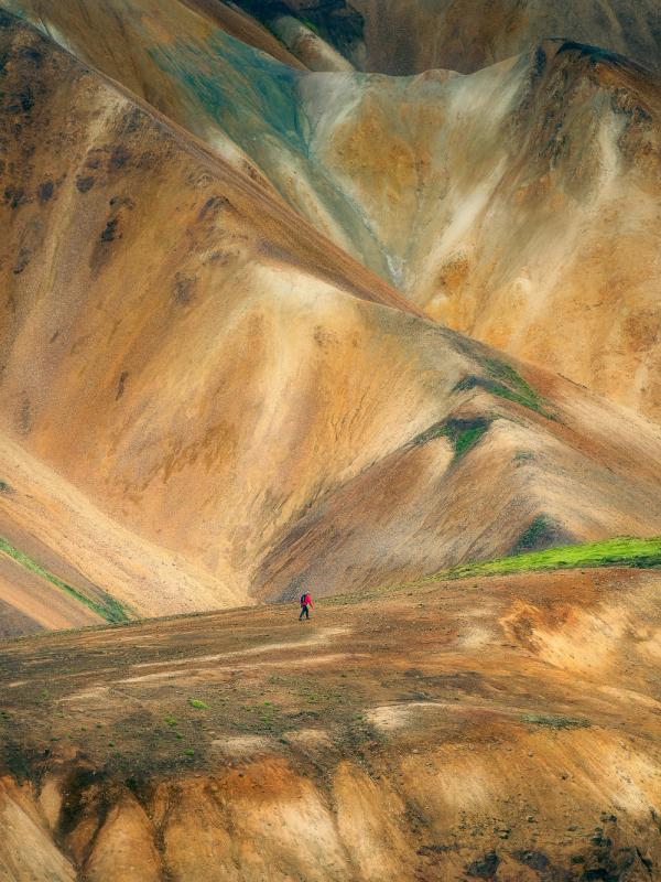
One of the most popular destinations in Iceland’s highlands is Landmannalaugar. This captivating place features colorful rhyolite mountains, nurturing hot springs, and a network of meandering trails. This hiking haven is set in the southern Highlands of Iceland, a paradise for nature lovers and hiking enthusiasts.
In this guide, we will cover everything you need to know about Landmannalaugar in Iceland. You’ll learn about the different ways to get there, the best time to visit, where to park your campervan at Landmannalaugar, and the best hiking routes as well.
Getting to Landmannalaugar
First things first, let’s cover how to get to Landmannalaugar. Located in the southern highlands, you’ll need to tackle Iceland’s F-roads to get there, which means you’re going to need a 4x4 campervan.
Driving to Landmannalaugar
There are three different routes to Landmannalaugar that you can take with your 4x4 camper.
- F208 North: This is the most popular and easiest route to get to Landmannalaugar. The drive is straightforward and is even on a paved road for a lot of the way. You’ll take the beginning of route F26 before turning south onto F208. There’s only one river crossing on this route, right at the end before entering the Landmannalaugar campsite.
- F225 West: This route to Landmannalaugar comes in from the west; F225 branches off Route 26 in the Thjórsárdalur Valley. The road is scenic, with three to four small river crossings that add a bit of excitement. In regular weather conditions, it’s a good place to practice your river crossings (following these guidelines). It does take longer to reach Landmannalaugar than if you were to take F208 North.
- F208 South: This final route is the most demanding of all three, with three major river crossings and several smaller ones. Connecting the southern stretch of Ring Road near Vik with Landmannalaugar, it is, however, the most scenic of the three routes. In pleasant weather, you should be able to tackle the rivers with one of our 4x4 campervans.
The Bus to Landmannalaugar
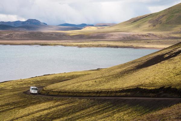
Just like Thorsmork in the southern Highlands of Iceland, there’s also a bus that can take you to Landmannalaugar. This is an excellent choice for those people wanting to experience Landmannalaugar in Iceland but don’t have a 4x4 campervan to get there.
Reykjavik Excursions operates the Highland Bus, which runs once daily between Reykjavik and Landmannalaugar. It stops in Selfoss, the supermarket in Hella, and the Rjúpnavellir cabins and campsite. If you have a campervan and still want to catch the bus to Landmannalaugar, we recommend leaving it at either Hella or Rjúpnavellir.
View the schedule and book your tickets here.
This highland bus to Landmannalaugar operates from June 15th to September 11th, with one return journey per day. The bus leaves Reykjavik at around 7:00 AM and is scheduled to arrive at Hella at 8:45 AM, then Rjúpnavellir at 9:20 AM. It arrives at Landmannalaugar at 11:30 AM.
The return bus then leaves Landmannalaugar at 15:45 – which doesn’t give you a lot of time, but just enough to squeeze in a good hike. Otherwise, you’ll need to stay the night and catch the bus back the next day. You can stay either in the Landmannalaugar cabin or in a tent at the campsite (for more accommodation information, see the section below).
Where to Stay in Landmannalaugar
When planning your stay in Landmannalaugar, it's essential to consider the variety of accommodation options available – or lack thereof.
The Campsite
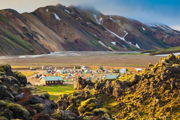
With a campervan, you can park at the campsite, right next to the mountain huts.
The cost to stay overnight at Landmannalaugar with a campervan is 2,500 ISK per person. If you want to have a hot shower while you’re there, it costs another 500 ISK.
If you’re going to use the campsite with a tent, it costs 2,000 ISK per person.
The Landmannalaugar Mountain Hut
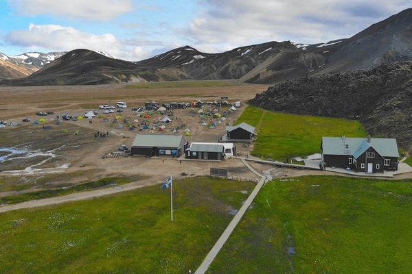
Operated by Ferðafélag Íslands, the Landmannalaugar mountain hut is open from June through to early October. It has bunk bed accommodation for up to 75 people, and reservations are required in advance. For those hiking the Laugavegur Trail, it’s a popular choice for staying before embarking on the trek, so it is often booked out in advance.
Request a bunk bed at the Landmannalaugar Mountain Hut here.
Best Time to Visit Landmannalaugar
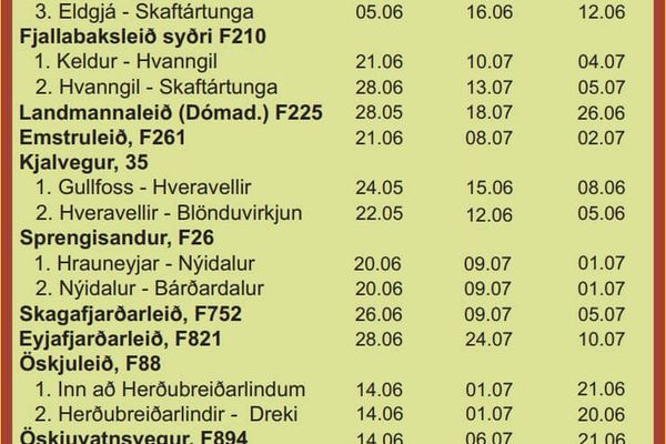
The best time to visit Landmannalaugar is anytime you can get there. However, the short window during which the area is open to 4x4 vehicles means that you don’t really have the luxury of picking a time to visit.
July and August are the busiest months, so for fewer crowds, you should aim to go during the second half of June or the first half of September. The trade-off, though, is that there’s a chance there might still be some snow cover.
As always, before setting out in your 4x4 campervan to Landmannalaugar, make sure to check the weather forecast.
Top Hikes in Landmannalaugar
Laugahraun Lava Field Loop
Length: 4.3 kilometers (2.6 miles)
Difficulty: Easy
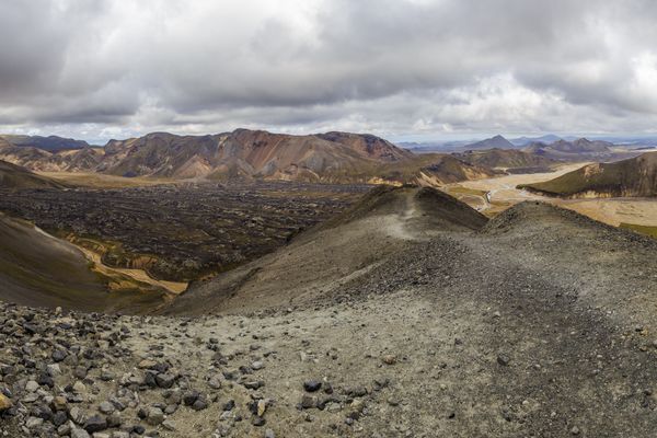
This popular route is not only Landmannalaugar’s most frequented day hike but also an easy and enjoyable adventure for all ages, offering an unparalleled view of the area’s dynamic volcanic landscape. Starting from the tourist information center, this accessible hike takes you across the rugged Laugahraun Lava Field, gives you good views of the colorful Landmannalaugar mountains and steaming geothermal features.
Brennisteinsalda Mountain – The Sulphur Wave
Length: 6.6 kilometers (4.1 miles)
Difficulty: Easy to moderate
Another popular day hike in Landmannalaugar is to ascend Mt. Brennisteinsalda, also known as the Sulphur Wave. This mountain is streaked with yellows, reds, and blues and offers incredible views over the entirety of the Landmannalaugar area. The hike begins from the campsite, where you’ll trek through the Graenagil Valley and across the lava field. Then you’ll scale the mountain, where incredible views await, before heading back down the other side into the valley Vondugil for some easy walking with magnificent views of the famous rhyolite mountains.
Blahnúkúr Mountain – Blue Peak
Length: 5.8 kilometers (3.6 miles)
Difficulty: Challenging
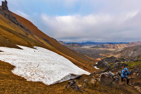
Bláhnúkur, a solitary grey-blue peak amidst the vibrant rainbow mountains, stands tall above the Landmannalaugar Campground. To conquer this summit, a trail traverses the lava field and then up sandy mountain switchbacks until you reach the rocky outcrop at the summit. Here, you can capture a photo of yourself against the backdrop of the multi-colored mountains or drink in the stunning views. While the hike is considered moderate, certain sections can be extremely steep, especially at the outset. Plan for a trek lasting two and a half to three and a half hours.
Ljótipollur Crater Lake
Length: 7.2 kilometers (4.4 miles)
Difficulty: Easy
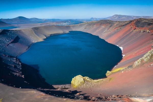
Translating to "Ugly Puddle" in English, the Ljótipollur Crater is a mesmerizing spot to hike to, despite its name. When the sun is out, the lake’s surfaces mirror the kaleidoscope of colors in the surrounding landscapes – from vibrant pinks, reds, and oranges of the iron-ore slopes to the deep blues and grays in the sky. The loop is 7.24 kilometers (4.5 miles), a moderate undertaking that can be completed in about two and a half hours from the Frostastaöavatn Lake parking lot. For those visiting Landmannalaugar in Iceland without a camper, you can also hike there from the campsite, but it’ll add an extra hour and thirty minutes onto your trek.
Sudurnamur
Length: 9.8 kilometers (6 miles)
Difficulty: Moderate
An immersive hike that leaves the crowds behind, Sudurnamur is another mountain peak nestled along the northern rim of the lava field. It’s a long trek and will take about half a day, but the rewarding vistas over the Laugahraun lava field, Vondugil Valley, the Blue Peak, and the Sulfur Wave are more than worth the effort. Rated moderate, the initial ascent is steep, but the trail levels out pleasantly along the mountain ridge, offering sweeping 360-degree views of the Torfajökull and Bárðarbunga volcanic systems. Commencing at the trailhead just before the river near Landmannalaugar, the path meanders along the F224 road for approximately one kilometer until crimson markers guide the way toward Sudurnamur. Following these markers, the path ascends gradually, leading onto a plateau before ascending again up to the peak. Allow three to five hours.
Grænihryggur Hike
Length: 16 kilometers (10 miles)
Difficulty: Challenging
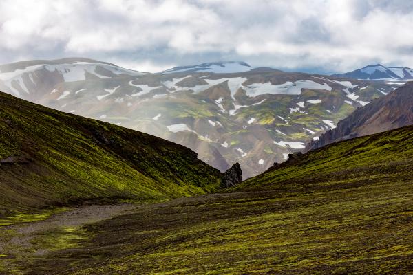
Deep within the Landmannalaugar area, the Grænihryggur trail remains one of Iceland’s best-kept secrets. This 16-kilometer (10-mile) out-and-back hike offers an immersive trek in some of the country’s most spectacular landscapes, yet surprisingly, it remains unknown to many travelers who visit Landmannalaugar. The literal translation of Grænihryggur is a “green ridge,” and that’s precisely what makes it special. The ridge that’s the aim of the hike boasts an otherworldly blue-green hue, unlike anything you’ll find on typical tourist routes like Bláhnúkur or Brennisteinsalda. Locals, who are often the only fellow hikers you’ll encounter, cherish this hidden gem. Expect a moderately difficult hike with some steeper and slippery sections. To get to the trailhead, you’ll need to jump back in your 4x4 campervan and head back to F208, turn right, and then drive along about 8km along the road until you see the trailhead (a small parking area).
The Landmannalaugar Hot Spring
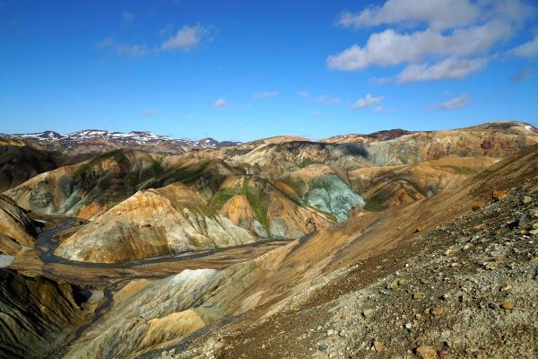
After a day of trekking through the stunning landscapes of Landmannalaugar in Iceland, there's nothing better than relaxing in the area’s large hot spring, right next to the campsite. Sitting somewhere between 36°C and 40°C (97°F to 104°F), it’s perfect for soaking sore muscles after a day on the trails.
Essential Tips
- Petrol: There are no services in Landmannalaugar, so you’ll need to fill up with petrol before driving there in your 4x4 camper. The best places to fill up with petrol are either somewhere in the Golden Circle region, in Selfoss, or at the ÓB Holtahreppur Vegamót located at the intersection of Route 1 and Route 26.
- Food: There’s an old bus called “The Mountain Mall” where you can get basic snacks, but there are no restaurants in Landmannalaugar. It’s advised to bring groceries to cook a meal.
- Weather: Make sure to check the weather forecast before tackling the F-roads to Landmannalaugar.
- Driving the F-roads to Landmannalaugar: For some tips and guidelines about driving on Iceland’s F-roads, check out this article.
- Landmannalaugar and the Highlands: For an idea of how you can visit Landmannalaugar as part of a larger journey through the Icelandic Highlands, check out this sample itinerary.
Conclusion
Getting to Landmannalaugar is part of the adventure. Whether you’re driving the rugged F-roads in a 4x4 camper or hopping on the Highland Bus, the journey is as much a highlight as the destination. Once you’re there, the stunning landscapes and epic hiking trails make all the effort worth it. Just remember to prepare well and soak it all in—this is Iceland at its best.
